The Digital Map Library Service was developed within the O.P. "Education" II “Upgrading of University of the Aegean Library” with the cooperation of the Cartography and Geo-Informatics Laboratory, Spatial Analysis, GIS and Remote Sensing Laboratory of the Department of Geography and the University of the Aegean Library. The creation of the Digital Map Library material began in September 2002 and was completed in February 2005.
Concerning the procedure for the creation of this material, at first, samples of digital map libraries were researched on the Internet to get an idea about the existing digital map libraries and the way in which they are organized and presented. The map libraries that came up were divided into two main categories: static and interactive digital map libraries.
Considering the available infrastructure, it was decided to initially develop a static digital map library. In the future, provided there will be appropriate infrastructure, the existing static maps could be converted into interactive ones.
The next target was to define the map categories so as to cover educational and research requirements of the Academic Society of the University of the Aegean. To this end, a questionnaire was sent to the faculty of this Institution, asking them to record their requirements for maps and to indicate which maps would include the required primary data. Moreover, a catalogue of available primary data of the Cartography and Geo-Informatics Laboratory of the University of the Aegean was sent to the faculty to select from. Finally, personal interviews with members of the faculty were added to the questionnaire results. Upon completion of the above processes, need for the creation of 82 maps which would meet the faculty requirements arose.
A database was created in which the maps were categorized according to subject, spatial context and the existence or not of digital and analog primary data for their recreation.
Priority was given to map making with available data. In the case when the data did not have the required format, appropriate processing was performed. In this way, 26 map categories were created.
Afterwards, information about the maps with no available data was sought. The main source for information was the Internet. The data was thoroughly checked for reliability and were appropriately formatted to compose the maps. From that point until the completion of the project, 29 additional maps categories were created.
The result of the entire project was the creation of 55 map categories which are, at this stage, presented on the Digital Map Library webpage, which was created by the technical support staff of the Library.
SATELLITE MAPS
- SATELLITE MAP OF NORTHERN AEGEAN
- SATELLITE MAP OF CORINTHUS
- SATELLITE MAP OF LESVOS
- SATELLITE MAP OF RHODES
- SATELLITE MAP OF ASIA
- SATELLITE MAP OF AFRICA
- SATELLITE MAP OF N. AMERICA
- SATELLITE MAP OF GREECE
- SATELLITE MAP OF EUROPE
- SATELLITE MAP OF S. AMERICA
- SATELLITE MAP OF OCEANIA
- WORLD SATELLITE MAP
POLITICAL MAPS
GEOLOGICAL-GEOMORPHOLOGICAL MAPS
- GEOMORPHOLOGICAL MAP OF LESVOS
- GEOMORPHOLOGICAL MAP OF GREECE
- GEOMORPHOLOGICAL MAP OF OF MEDITERRANEAN SEA
- WORLD SEISMOTECTONIC MAP
- HYDROGRAFIC NETWORK OF GREECE
NATURAL ENVIRONMENT MAPS
- WORLD GEOGRAPHICAL VEGETATION DISTRIBUTION
- WORLD GEOGRAPHICAL DISTRIBUTION OF CLIMATIC TYPES
- GEOGRAPHICAL VEGETATION DISTRIBUTION OF EUROPE
- WORLD DISTRIBUTION OF RAINFALLS
- DISTRIBUTION OF RAINFALLS IN GREECE
- DISTRIBUTION OF TEMPERATURE IN GREECE (JANUARY 2005)
- DISTRIBUTION OF TEMPERATURE IN GREECE (JULY 2004)
- WORLD DISTRIBUTION OF TEMPERATURE OF AIR(JANUARY 2005)
- WORLD DISTRIBUTION OF TEMPERATURE OF AIR(JULY 2004)
- SIGNIFICANT NATURAL DESTRUCTIONS IN GREECE
SOCIO-ECONOMIC MAPS
- GROSS NATIONAL PRODUCT (AEP) BY SECTOR FOR THE YEARS THE 1981, 1991 & 1994
- GROSS NATIONAL PRODUCT (AEP) OF THE PREFECTURES OF GREECE FOR THE YEARS 1981, 1991 & 1994
- OBJECTIVE VALUES IN MYTILENE
- WORLD GEOGRAPHICAL DESTRIBUTION OF POPULATION
- AGEING POPULATION OF PREFECTURES OF GREECE FOR THE YEARS 1951, 1971 & 2001
- DIACHRONIC DEVELOPMENT OF UNEMPLOYMENT OF THE REGIONS OF GREECE FOR THE YEARS 1988, 1990, 1992, 1994, 1996, 1998 & 2000
- DIACHRONIC DEVELOPMENT OF EMPLOYMENT OF THE PREFECTURES OF GREECE BY SECTOR FOR THE DECADES THE 1971, 1981 & 1991
- DIACHRONIC DEVELOPMENT OF EMPLOYMENT OF THE REGIONS OF GREECE FOR THE YEARS 1988, 1990, 1992, 1994, 1996, 1998 & 2000
- DIACHRONIC DEVELOPMENT OF EMPLOYMENT OF THE PREFECTURES OF GREECE FOR THE DECADES 1971, 1981 & 1991
- DIACHRONIC DEVELOPMENT OF THE COMPOSITION OF POPULATION OF THE PREFECTURES OF GREECE FOR THE DECADES 1971, 1981 & 1991
- DIACHRONIC DEVELOPMENT OF POPULATION OF THE REGIONS OF GREECE FOR THE PERIOD 1951-2001
- GROSS NATIONAL PRODUCT PER CAPITA BY THE PREFECTURES OF GREECE FOR THE YEARS 1981, 1991 & 1994
- PER CAPITA CONSUMPTION BY COUNTRY FOR THE YEAR 1997
- PRODUCTIVITY PER EMPLOYEE BY SECTOR FOR THE DECADES 1981 & 1991
- POPULATION DENSITY OF THE PREFECTURES OF GREECE FOR THE YEAR 2001
- POPULATION OF THE PREFECTURES OF GREECE FOR THE YEAR 1951
- POPULATION OF THE PREFECTURES OF GREECE FOR THE YEAR 1961
- POPULATION OF THE PREFECTURES OF GREECE FOR THE YEAR 1971
- POPULATION OF THE PREFECTURES OF GREECE FOR THE YEAR 1981
- POPULATION OF THE PREFECTURES OF GREECE FOR THE YEAR 1991
- POPULATION OF THE PREFECTURES OF GREECE FOR THE YEAR 2001
- PERCENTAGE DISTRIBUTION OF THE COMPOSITION OF POPULATION OF THE REGIONS OF GREECE FOR THE YEAR 2001
- PERCENTAGE DISTRIBUTION OF THE COMPOSITION OF POPULATION OF THE PREFECTURES OF GREECE FOR THE YEAR 2001
- GROSS NATIONAL PRODUCT GROWTH PER CAPITA BY COUNTRY FOR THE YEAR 1999
- COMPOSITION OF POPULATION OF THE REGIONS OF GREECE FOR THE YEAR 2001
- COMPOSITION OF POPULATION OF THE PREFECTURES OF GREECE FOR THE YEAR 2001
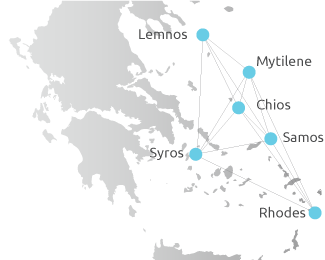
All maps can potentially be used to support the future interactive Digital Map Library environment as well. Indicatively the following interactive maps have been created:
Since 2006 when the Library portal was completed, the Digital Map Library was incorporated into the portal to provide the connected user with a friendly and easy to use interface and personalized services based on access permissions, attributes and capacity.
The composition of each map category, which includes the stages of information collection, data processing and map synthesis, was the result of the cooperation between the implementation group of the Digital Map Library and the assigned professor, who required the particular map category.
The map implementation group consisted of:
- Mr Nikolaos Soulakellis, Associate Professor of the University of the Aegean, Geography Department, in charge of the Department of Cartography and Geo-informatics
- Mrs Christina Dimitriadou, Geographer and the person in charge of the digital service of the Digital Map Library in the Library
- Mr Vasileios Kakouris, Geographer and Library Associate for the O.P. "Education" II “Upgrading of University of the Aegean Library”
The design and development of the website for displaying the static digital maps was implemented by the Technical Support staff of the Library.